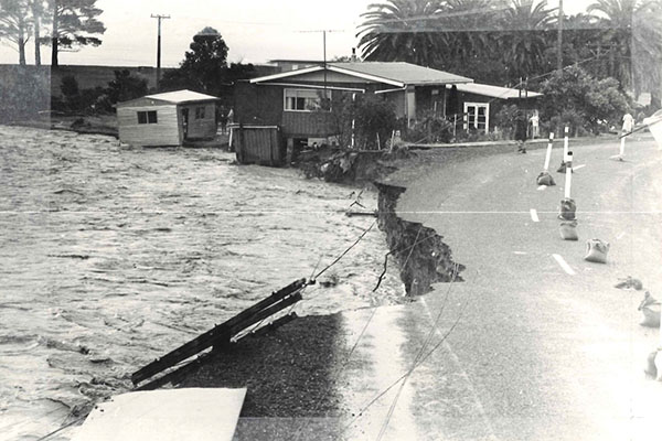
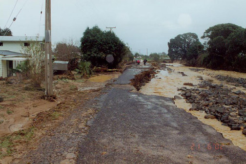
The Coromandel Peninsula is highly flood prone because it has short, steep catchments that run from the Coromandel Range straight to the coast, and it’s subjected to intense, localised rainfall, often from ex-tropical cyclones.
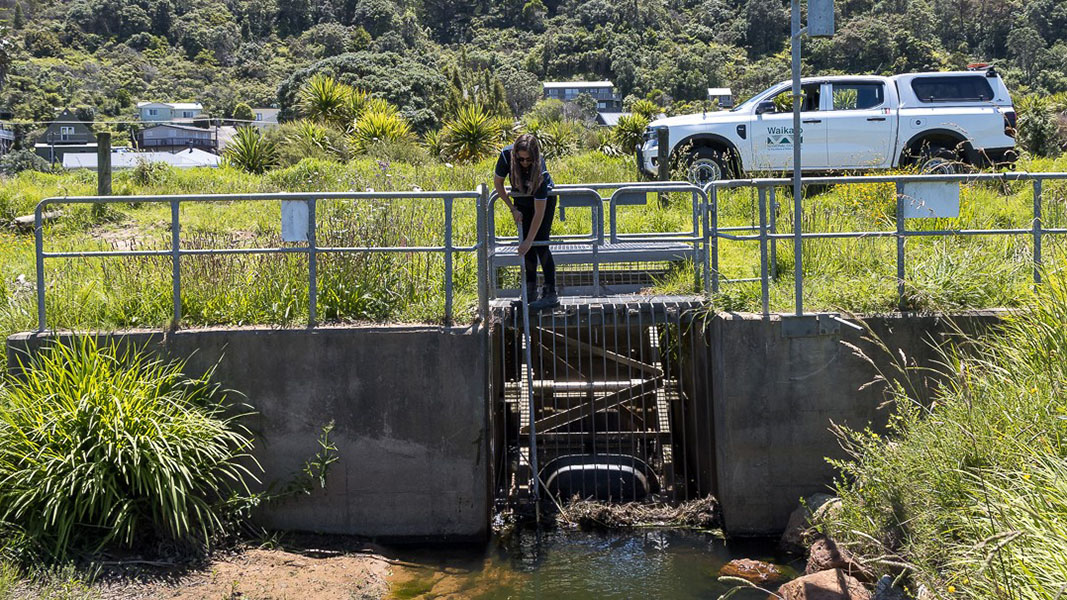
During flood, high sediment loads and debris from the native forest can choke the stream channels, intensifying flood impacts on the townships, properties and infrastructure in the lower catchments.
There are five small schemes in the Coromandel Peninsula, at Te Puru, Waiomou, Tapu, Coromandel and Tairua. All arose from the Peninsula Project, which was set up to address river and catchment issues in the Coromandel Peninsula after the “Weather Bomb” of 2002.
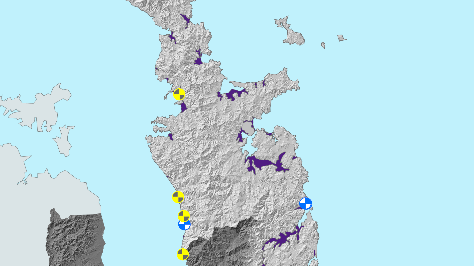
The yellow and blue areas on this map show the locations of the flood protection schemes on the Coromandel Peninsula. The purple areas indicate land that may be susceptible to flooding based on historical event records, flood modelling, flood protection and drainage scheme data, and elevation information.
Use our interactive flood protection and land drainage map to find out if there are any scheme assets protecting your area, or your favourite Waikato location.
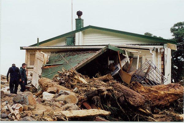
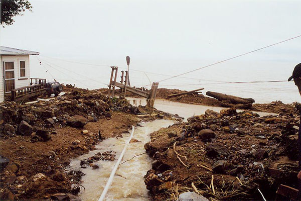
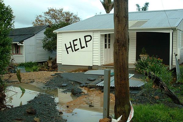
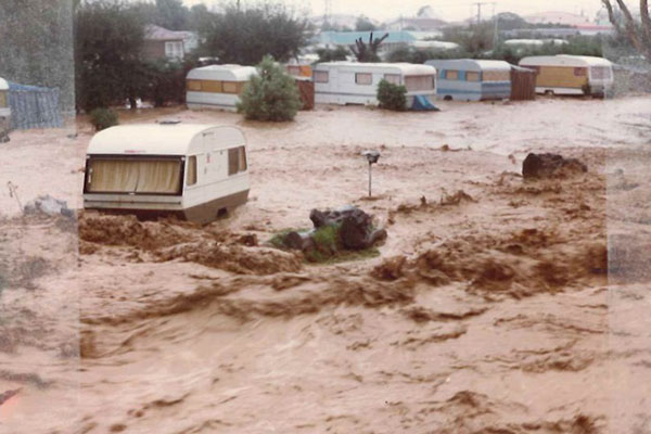
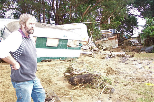
Communities in the Coromandel Peninsula suffered significant damage during the Weather Bomb of 2002, which led to the Peninsula Project to address river and catchment issues, including small flood protection schemes for Te Puru, Waiomou, Tapu and Coromandel town.
Te Puru flood protection scheme
-
Te Puru suffered significant damage during the Weather Bomb in 2002, with water carrying trees and debris coming down the hills, through the campground and into all the homes along the sea. Due to community feedback, a full flood mitigation scheme was not constructed. The scheme is designed to handle a 1% annual exceedance probability (AEP), which is often called a 1-in-100-year flood event. It was agreed to by the community, who benefits and pays for it via targeted rates, and was completed around 2010. The main channel of the Te Puru Stream is monitored and periodically maintained to remove accumulated sediment and debris.
Waiomu flood protection scheme
-
Waiomu sustained significant damage to properties and a loss of life during the Weather Bomb in 2002. Due to community feedback, a full flood mitigation scheme was not constructed. The scheme is designed to handle a 2% annual exceedance probability (AEP), which is often called a 1-in-50-year flood event. It was agreed to by the community, who benefits and pays for it via targeted rates.
Tapu flood protection scheme
-
The Tapu community was identified as having a very high risk to life and property due to flooding. Due to community feedback, a full flood mitigation scheme was not constructed. The scheme primarily protects the campground and was constructed in 2009 with funds from Thames-Coromandel District Council. It is designed to handle a 1% annual exceedance probability (AEP), which is often called a 1-in-100-year flood event.
Coromandel town flood protection scheme
-
The Coromandel town community identified as having a very high risk to life and property due to flooding of the Whangarahi and Karaka streams. Due to community feedback, a full flood mitigation scheme was not constructed. The scheme provides protection only to the central business district and residential dwellings in the vicinity of the Kapanga Bridge Road. It is designed to handle a 1% annual exceedance probability (AEP), which is often called a 1-in-100-year flood event. The scheme was agreed to by the community, who benefits and pays for it via targeted rates.
Grahams Creek (Tairua) flood protection scheme
-
Low-lying properties at the base of the catchment were regularly subjected to flood hazard from the Graham Stream. The scheme was agreed to by the community, who benefits and pays for it via targeted rates. It is designed to handle a 1% annual exceedance probability (AEP) (often called a 1-in-100-year flood event) along the right bank of Grahams Stream and a 2% AEP (1-in-50-year flood event) along the left bank and has been operational since 2016.