Shoreline change
Why we monitor shoreline change
Sandy beaches are naturally prone to changes in shoreline position, also known as erosion and accretion. Shoreline change occurs in response to major storms and changes in climate patterns over longer time periods.
Individual storms can cause the dune to erode by several metres over periods of hours or days. This erosion often recovers naturally in the following months. It can take many years for a beach to recover from a major storm. A trend for erosion or beach building can also occur over a decadal cycle, usually in response to climatic cycles, such as ENSO (the El Niño - La Niña cycle).
Sandy beaches are popular recreational assets for the community and many of our coastal housing developments have been built very close to the shoreline. Houses and infrastructure that have been built close to the sea are vulnerable to these natural fluctuations.
Engineered structures such as seawalls are sometimes placed on the beach to protect at-risk assets, but these can damage the natural and recreational values of the beach and can transfer the erosion risk to the adjacent coastline.
Councils need to understand the extent of natural beach change to sustainably guide existing and new developments on these coasts. A key focus of the New Zealand Coastal Policy Statement (NZCPS 2010) is reducing, and where possible avoiding, coastal hazard risk and in turn this is an important part of regional and district council plans. Shoreline change information is one tool that can be used to understand which areas of coastline are at risk from erosion due to natural processes over periods of decades.
Results - data and trends
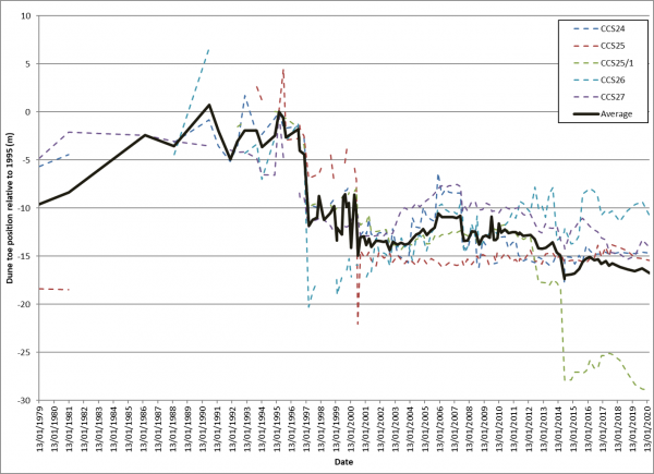
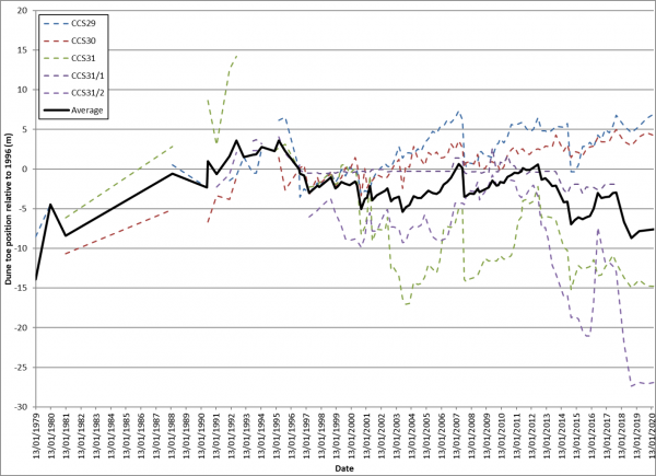
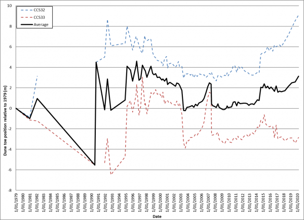
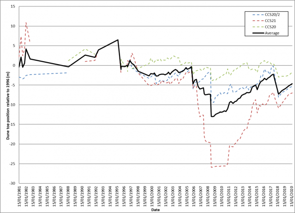
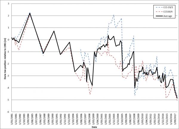
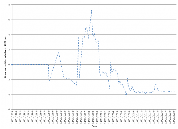
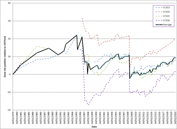
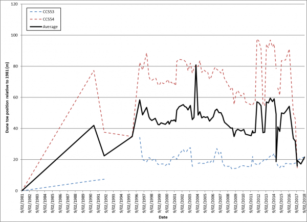
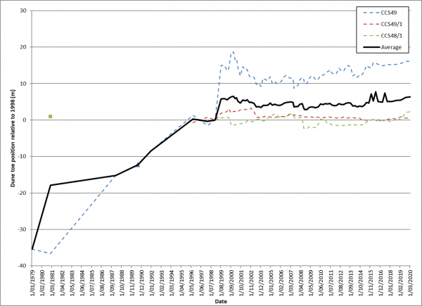
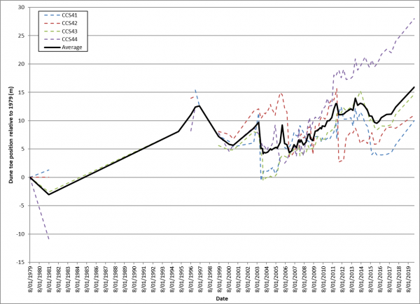
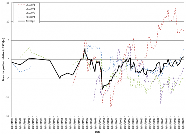
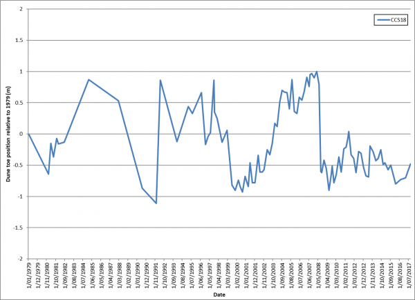
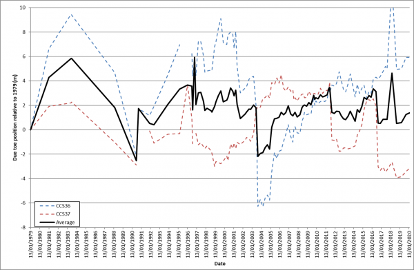
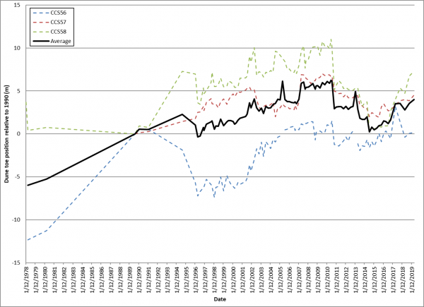
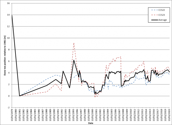
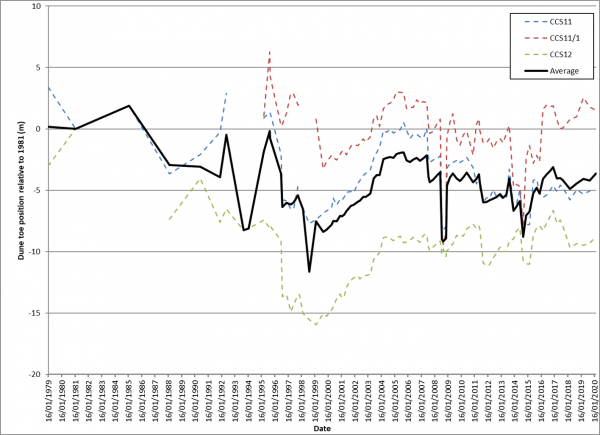
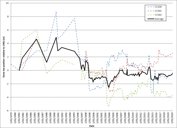
This indicator monitors shoreline change at a subset of sandy beaches on the Coromandel Peninsula. We measure changes in the location of the dune toe.
Our data shows that, in general, the position of the dune toe along beaches fluctuates, but there is no clear widespread long term (permanent) shoreline change. Shorelines don’t all respond in the same way to any one storm.
The position of the dune usually fluctuates by 10-15 m and occasionally up to 25 m. Shoreline fluctuations can be even larger near stream or estuary entrances, where the toe of dune can move by up to 100 m. In some cases, hard materials underneath the sand limit the extent of erosion that can occur.
While most beaches seem quite stable now, a long-term trend for erosion may occur in response to climate change due to either accelerated sea level rise or a modified wave climate.
Site specific influences on shoreline change are summarised below. The graphs show horizontal shoreline changes since beach profile records began.
The Excel data file below contains the source data for this indicator's information.
Methods - how we monitor shoreline change
More information
When this indicator is updated
This indicator is updated every two years, with the next update scheduled for 2021/22.
Last updated June 2020

