Constituencies
Constituency boundary maps
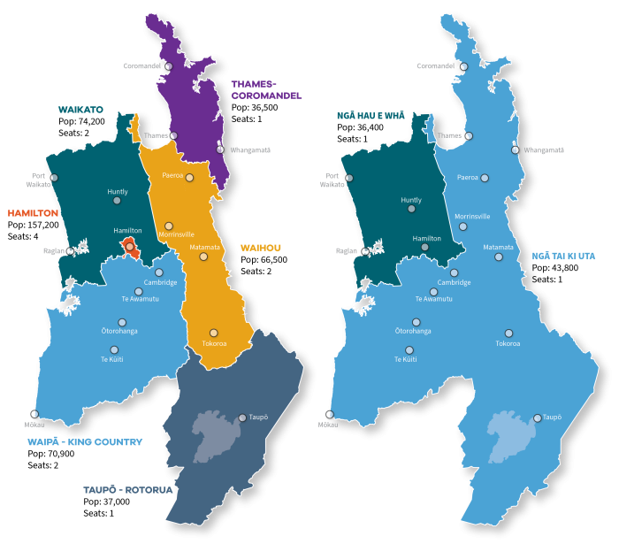
View our consitutency maps and boundaries. Enter a property address into our interactive mapping tool (see the link below) and find out what constituency the property is in.
Note: These maps were last updated in June 2025.
The maps use provisional Constituency 2025 datasets from Stats NZ. The final versions will be released later in 2025.
Enter your address, and view your property
To use the mapping tool
- click the drop-down arrow to expand the Constituencies list in the right hand menu
- deselect (un-tick) the constituency type option that doesn't apply (either General or Māori).
- click the drop-down arrow to expand the required constituency type, and view its boundary colours
- enter your address in the Search for address field (top left of screen).
- The map will then show your property in the correctly coloured location.
- You can zoom in and out of the map, using the + and - buttons, and move around using the arrow buttons or by click and dragging the map.